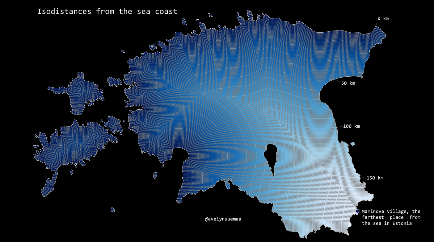
Isolines are very efficient way to map quantitative data as lines. The current map is representing 1km-isodistances from the Baltic sea. The farthest village from the sea in Estonia is Marinova village (approx 185km from the coast).
Methods: 1km buffers were generated to the coastline. 10 km zone were extracted and converted into lines to emphasize the 10km-isolines.
Data: Estonian Land Board Generalised Estonian Topographic Database
Tools: QGIS