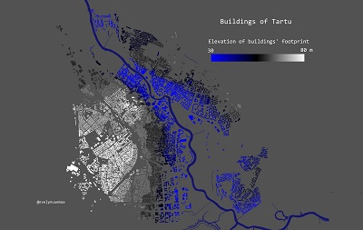
Day 30 - Home
The 30th and the last day - HOME. For the last 25 years, I can call Tartu my hometown. Therefore I mapped the buildings of Tartu by their footprint elevation...
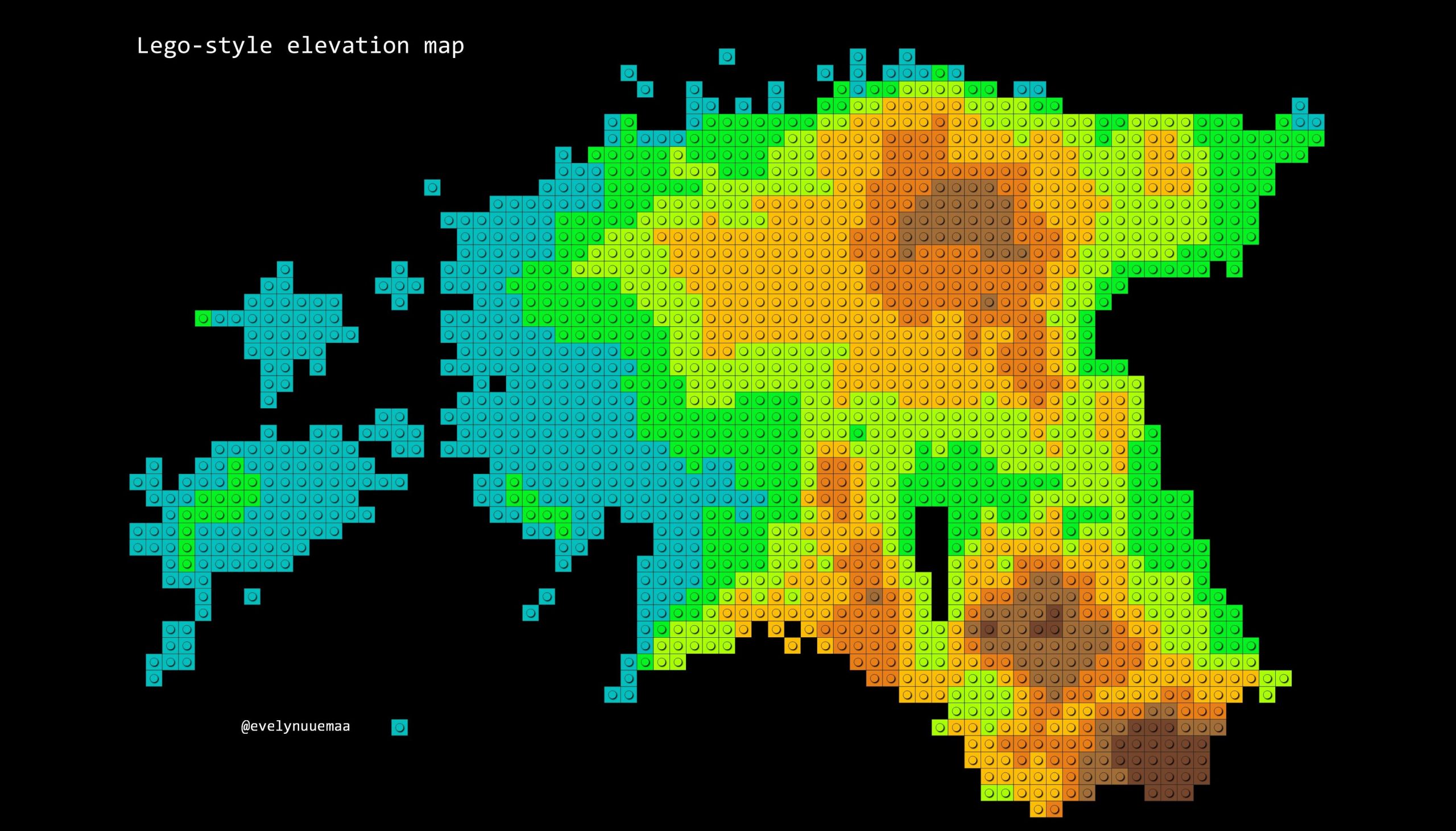
Day 29 - Lego-style elevation map of Estonia
The 29th day - EXPERIMENTAL. From the moment I saw Andriy Yaremenko’s tutorial for making LEGO maps, I knew I want to try it out myself. Super simple and a l...
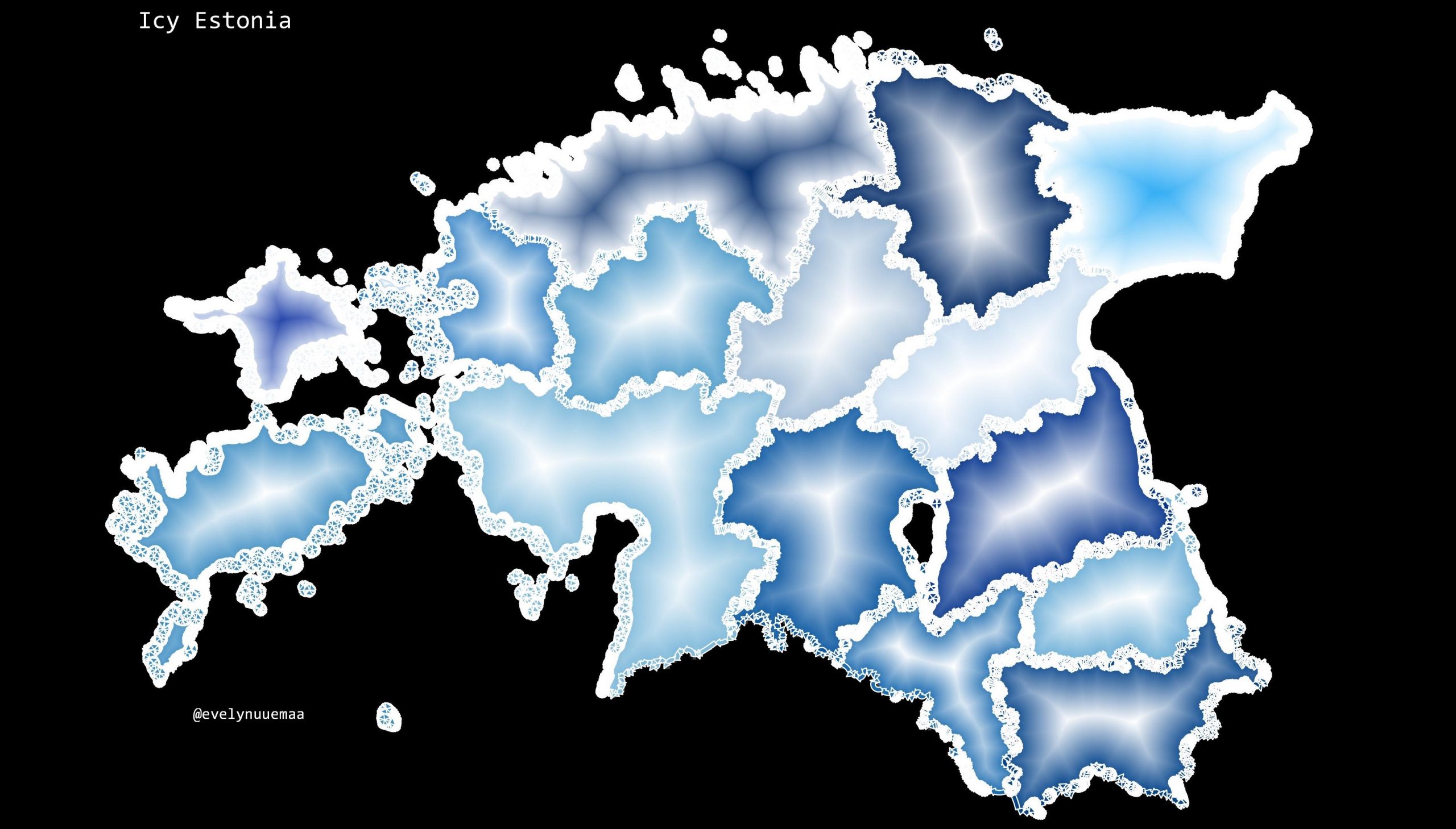
Day 28 - Funny - Icy Estonian counties at the end of November
The 28th day - FUNNY. The last days have been extremely icy and slippery in Estonia. Therefore this map was inspired by the current weather conditions. I use...
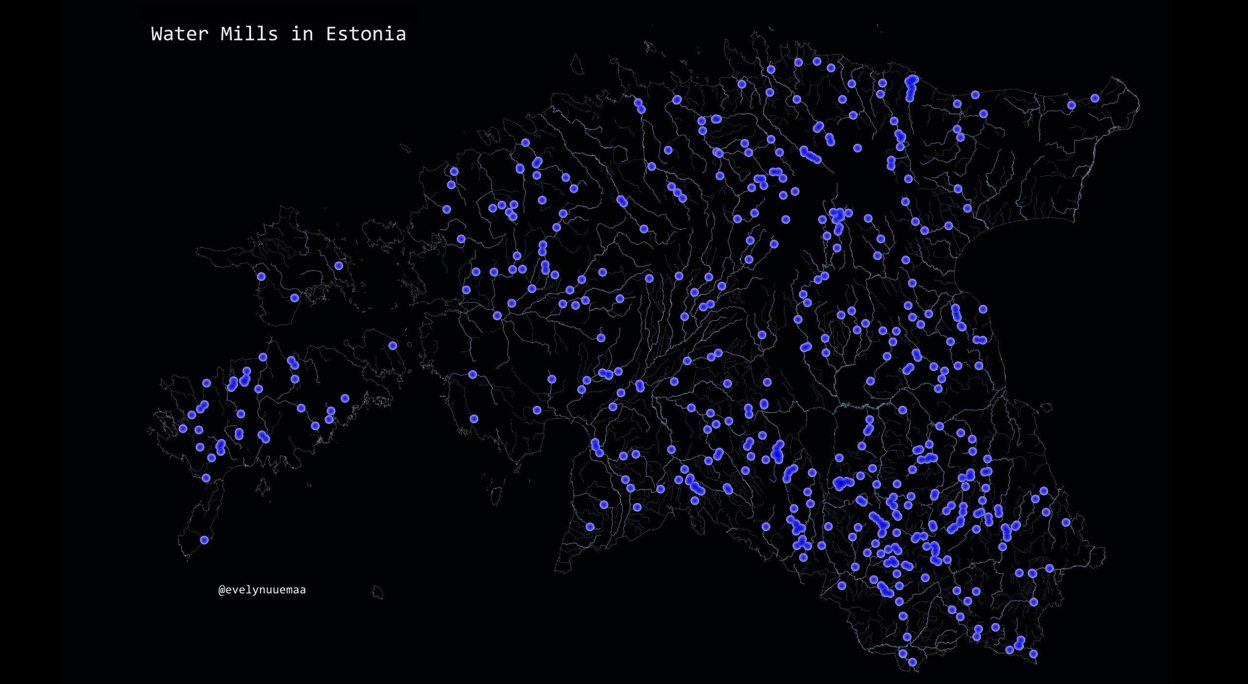
Day 27 - Resources - Water mills in Estonia
The 27th day - RESOURCES. Tribute to water mills – our forgotten resource. Estonia is full of small water mills that nowadays are mostly not working anymore....
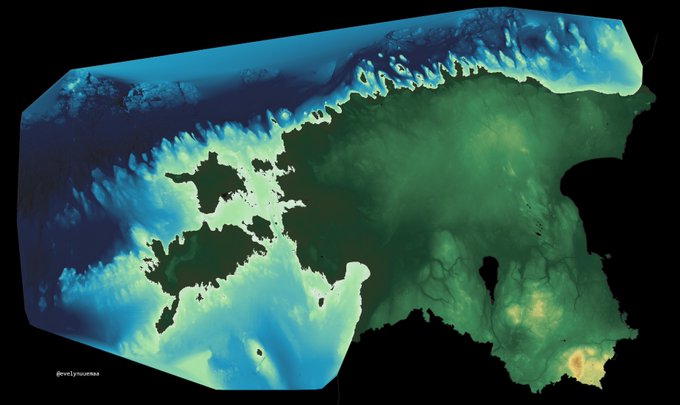
Day 26 - Hydrology - Bathymetry of the Baltic Sea along the Estonian coast together with the elevation map of Estonia
The 26th day - HYDROLOGY.
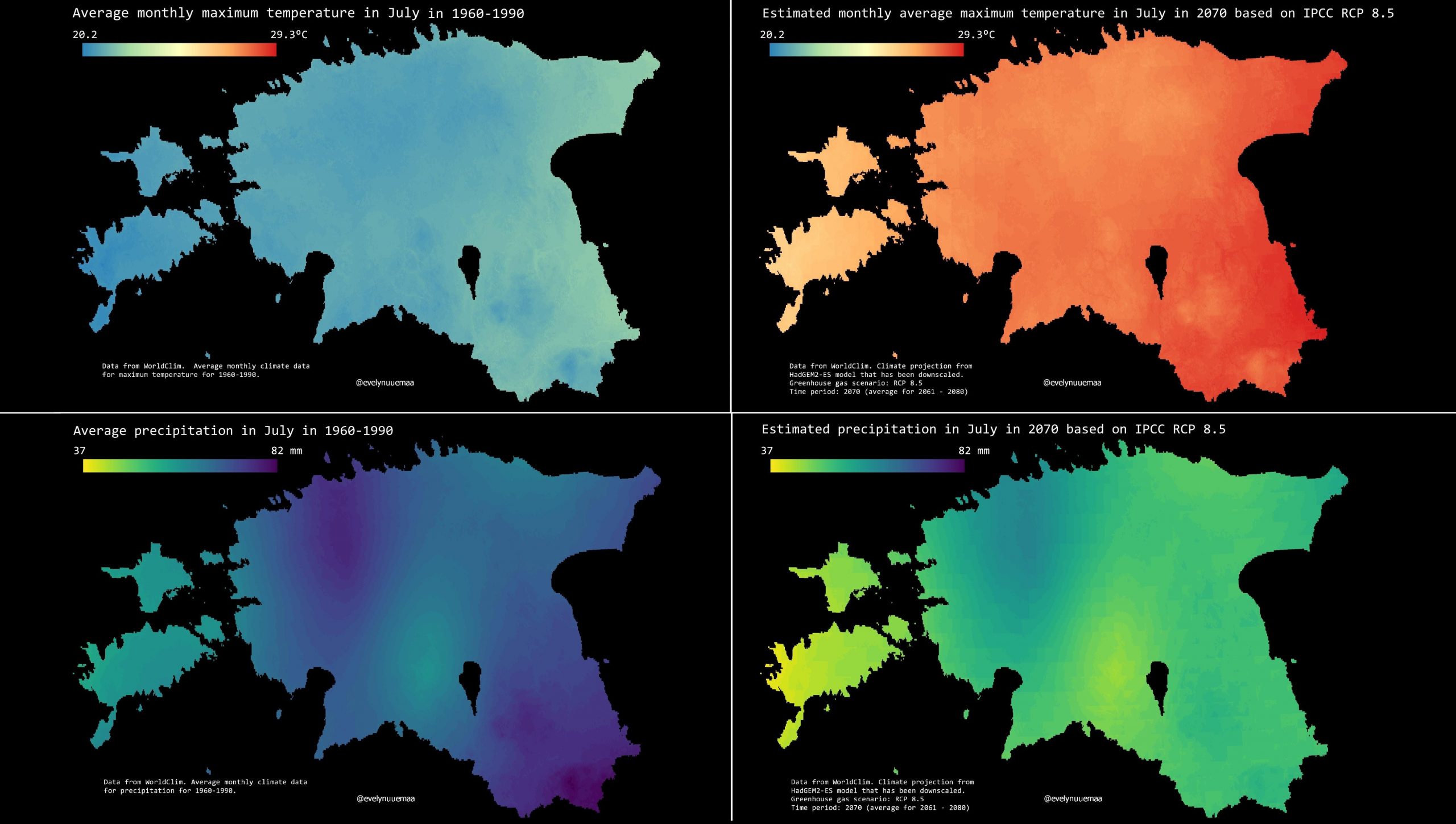
Day 25 - Climate - Long-term average data and “nightmare” scenario for 2070
THe 25th day - CLIMATE.
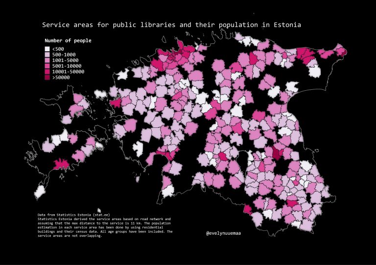
Day 24 - Statistics - Service areas for public libraries and population living in the service areas
The 24th day - STATISTICS.
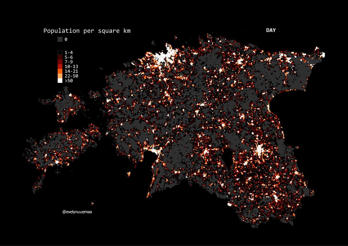
Day 23 - Population - Estonian population per square km during the day and night
THe 23rd day - POPULATION.
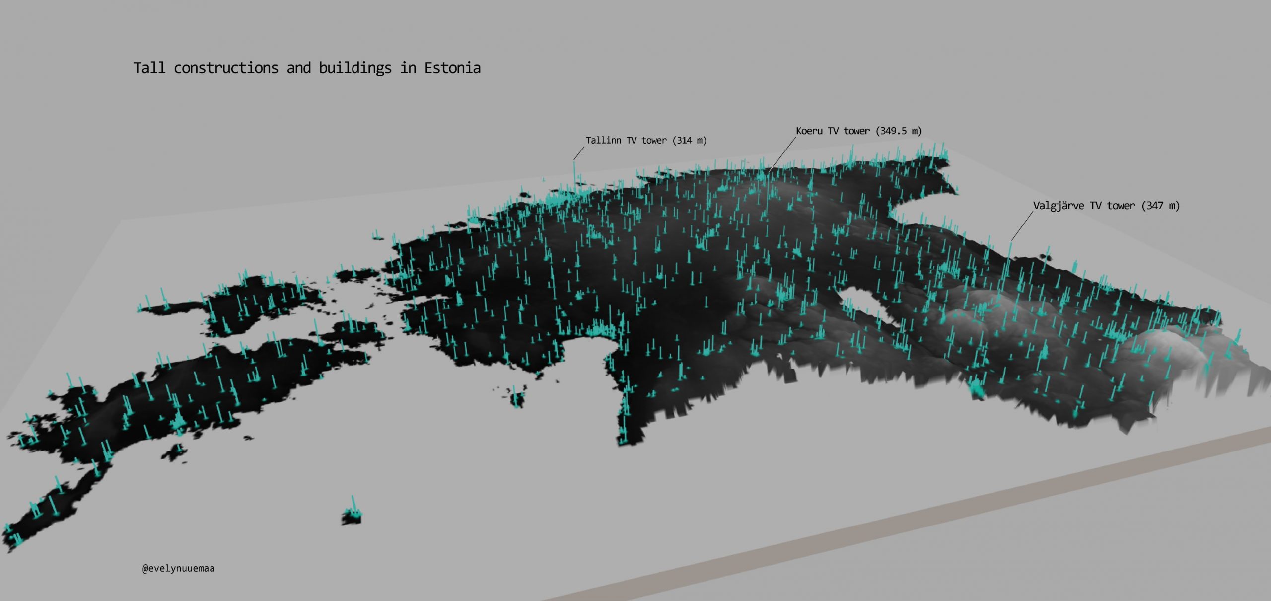
Day 22 - Built environment - Tall buildings and structures in Estonia
The 22nd day - BUILT ENVIRONMENT.
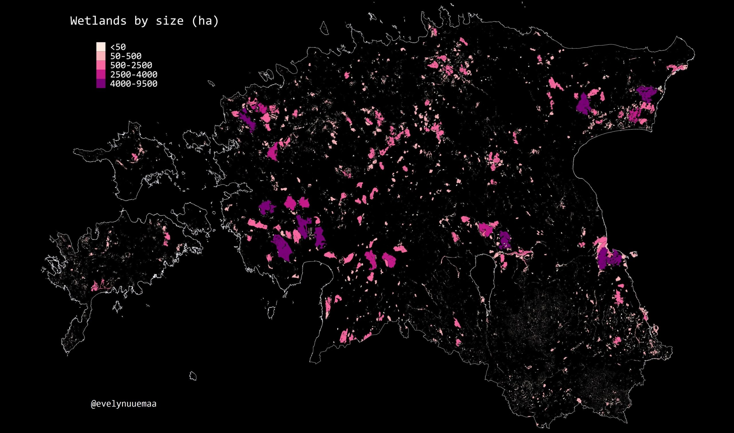
Day 21 - Environment - Wetlands in Estonia
The 21st day - ENVIRONMENT. Wetlands are in most parts of the world lost environments. Estonia has been blessed with many wetlands - almost 40 000 and rang...
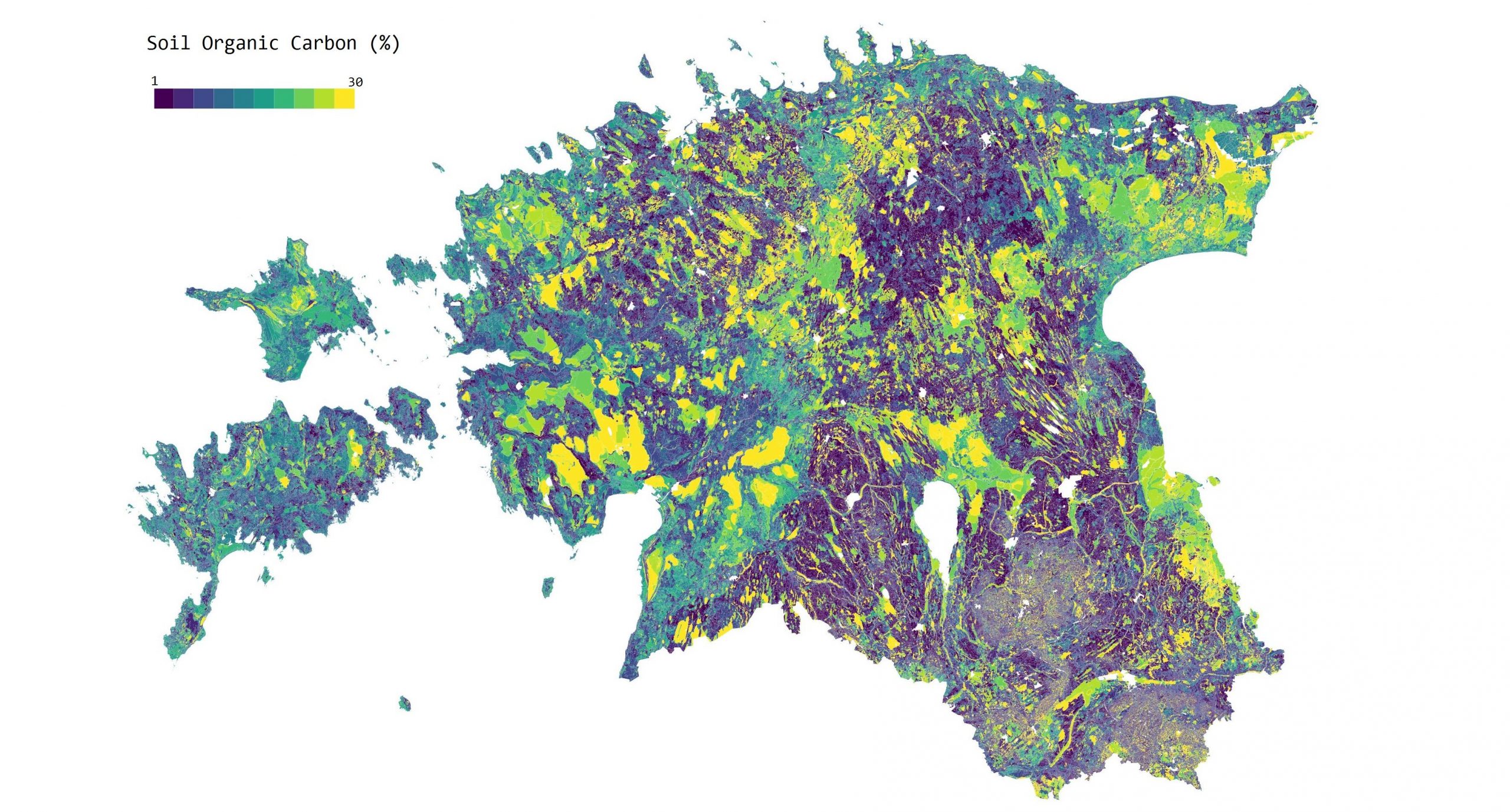
Day 20 - Rural - Soil organic carbon
The 20th day - RURAL. Soil organic carbon as one of the very important ecosystem services in terms of agriculture. Modelled by our Landscape Geoinformatics t...
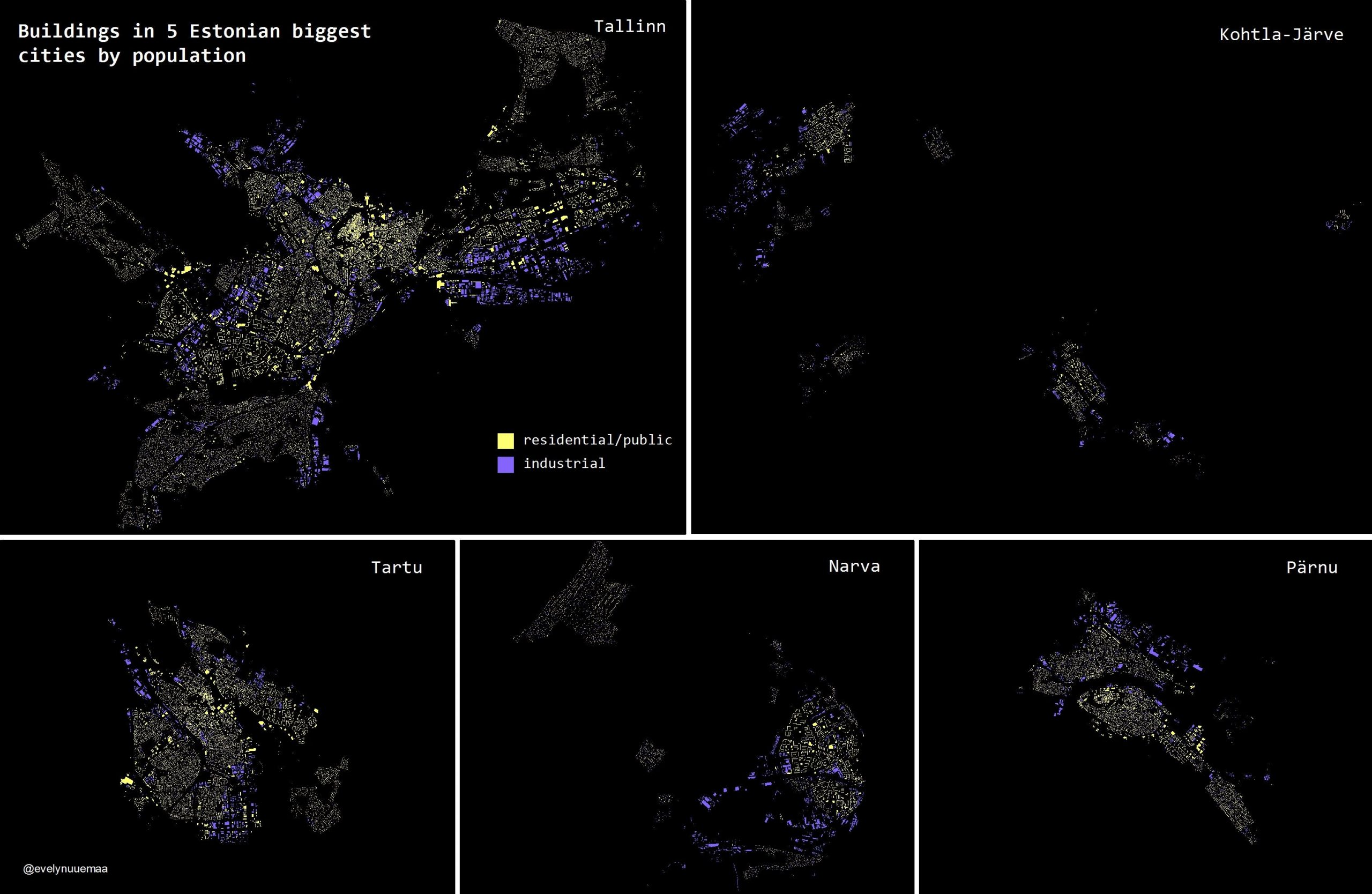
Day 19 - Urban - Buildings in the 5 Estonian biggest cities by population
The 19th day - URBAN. I used buildings’ data from Estonian Topographic Database. I selected 5 biggest cities by population according to Estonian Statistics B...
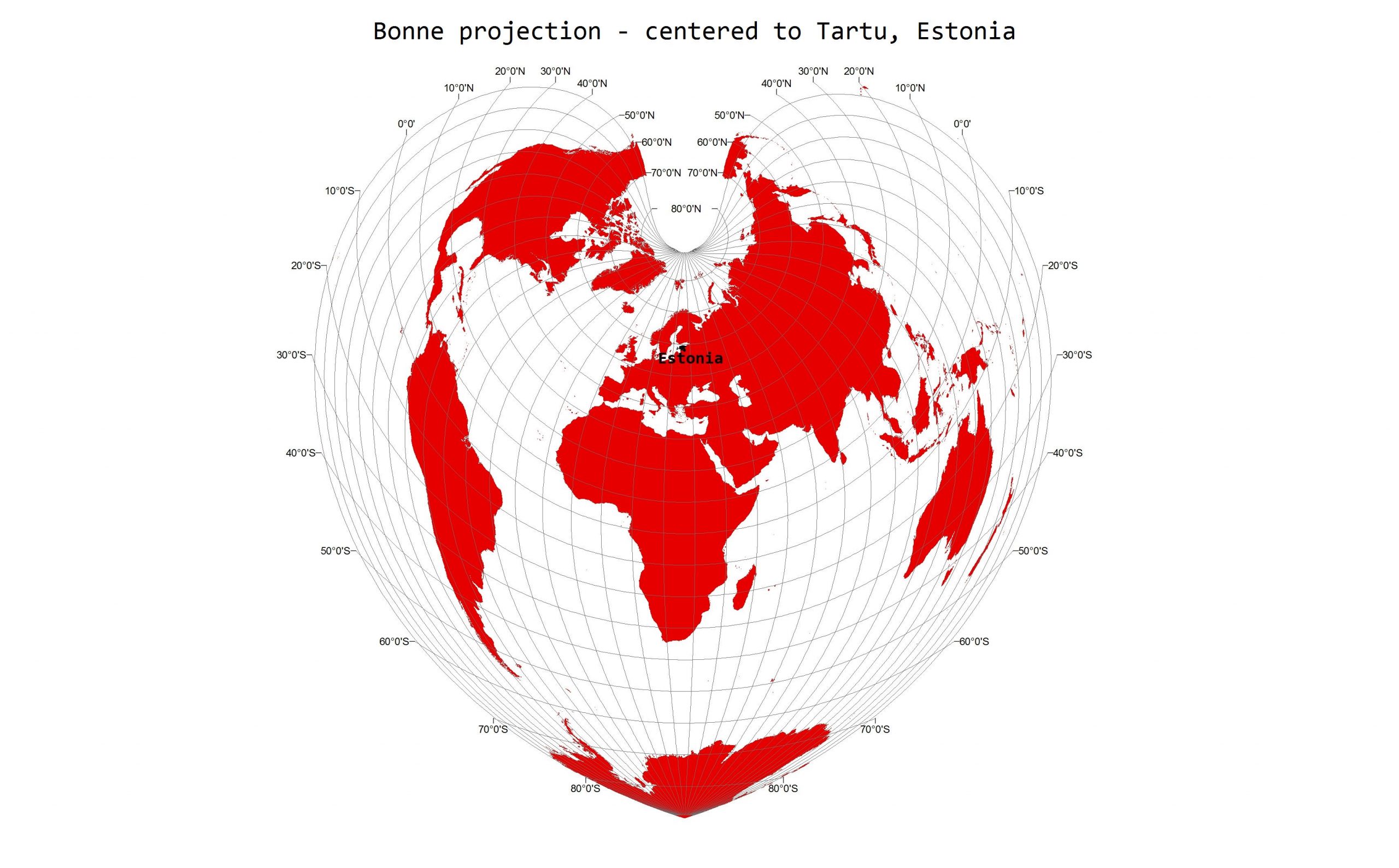
Day 18 - Globe - Bonne projection centered to Tartu, Estonia
The 18th day - GLOBE. I used Natural Earth country borders and projected it to Bonne projection (EPSG 54024) that I centered to Tartu. Bonne projection is a ...
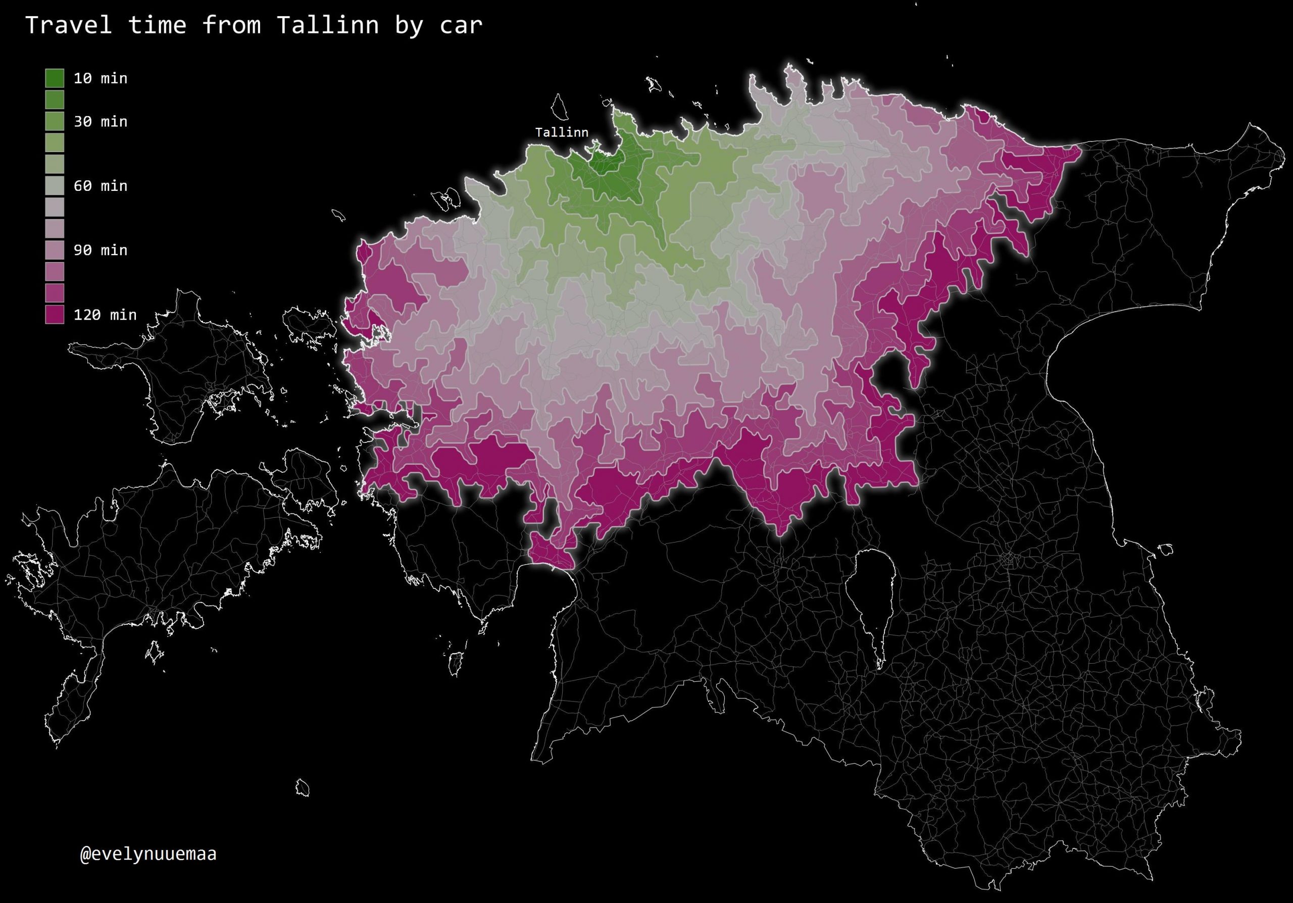
Day 17 - Zones - How far you can travel by car in 2 hours from Tallinn city center
The 17th day - ZONES.The travel time can be represented as isochrones. HERE provides global travel time data. QGIS has Hqgis plugin that enables to use isoch...
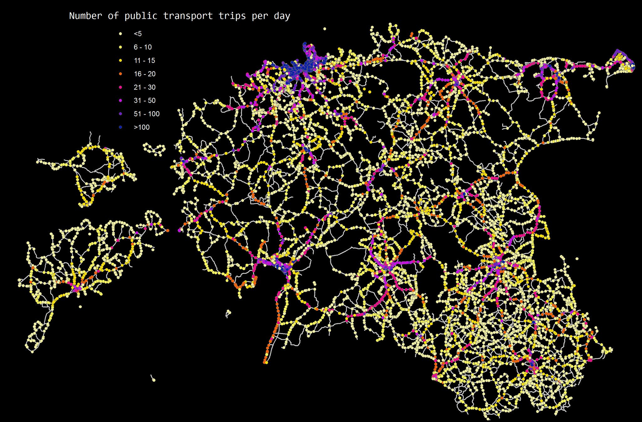
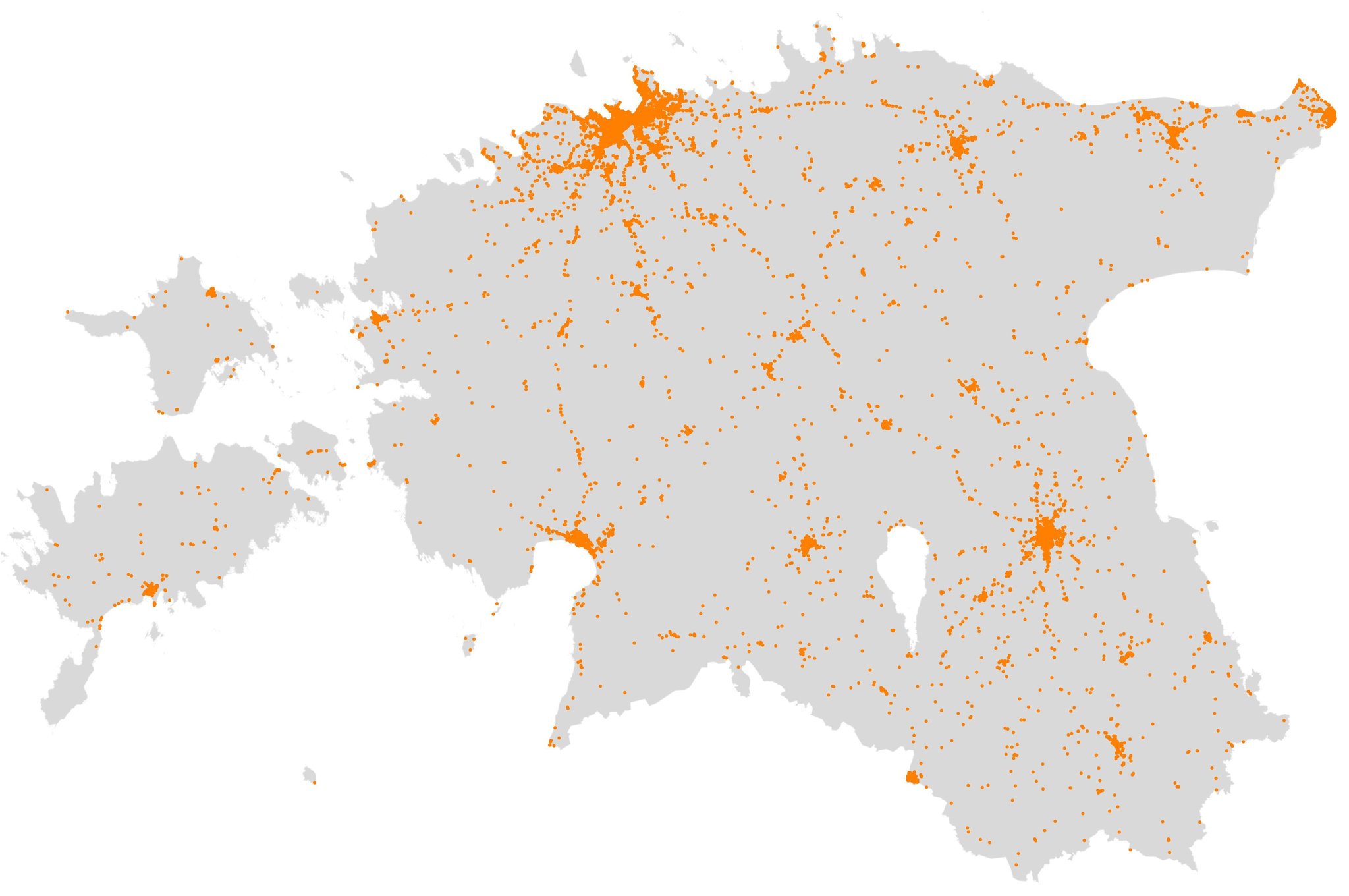
Day 16 - Places - Bus stops based on number of public transport trips per day in Estonia
The 16th day - PLACES.
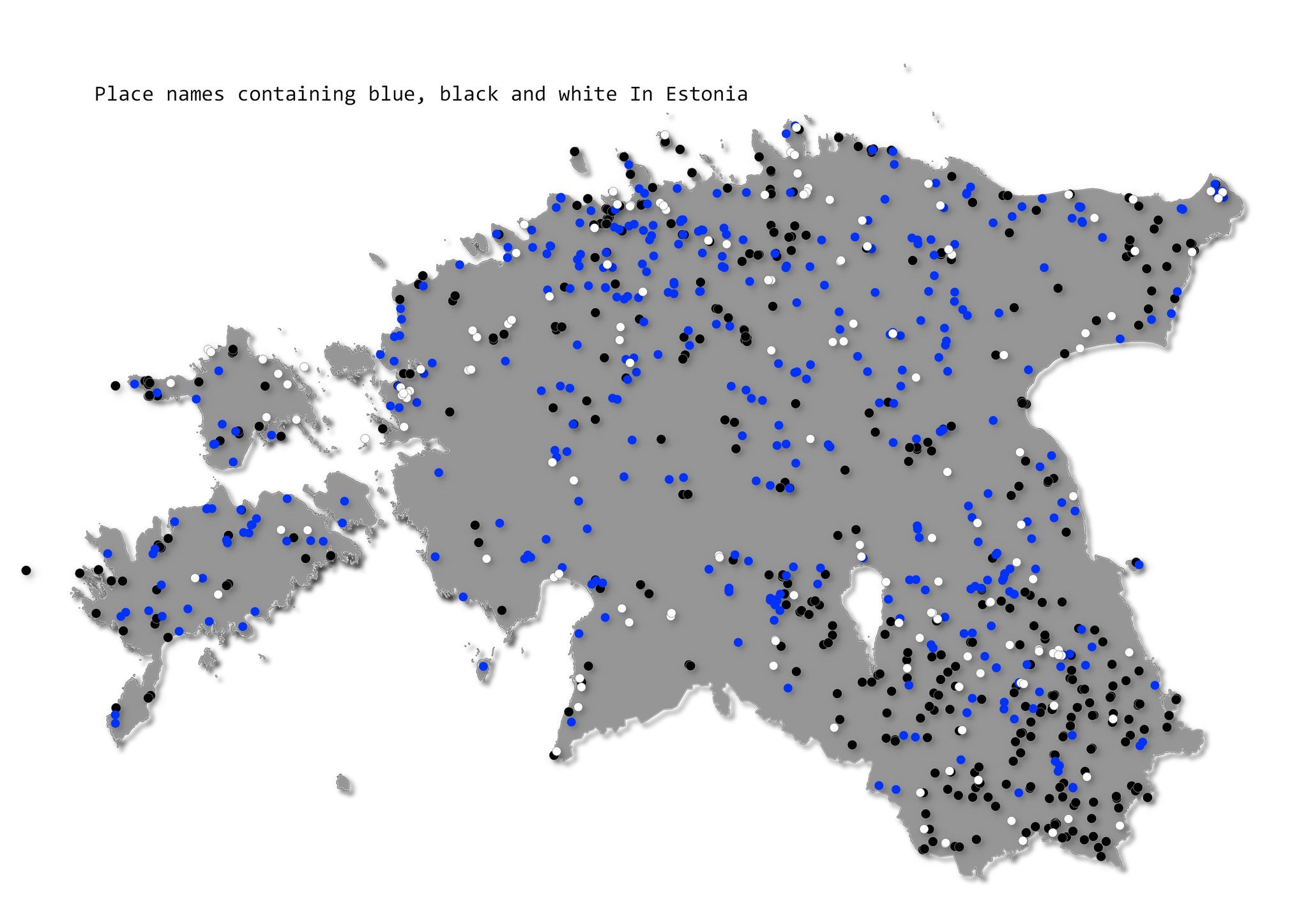
Day 15 - Names - Places that contain the words blue, black, or white in their names
The 15th da - NAMES. A simple idea to visualise place names in Estonia that contain words “sini”, “must”, and “valge” (blue, black, white - Estonian flag col...
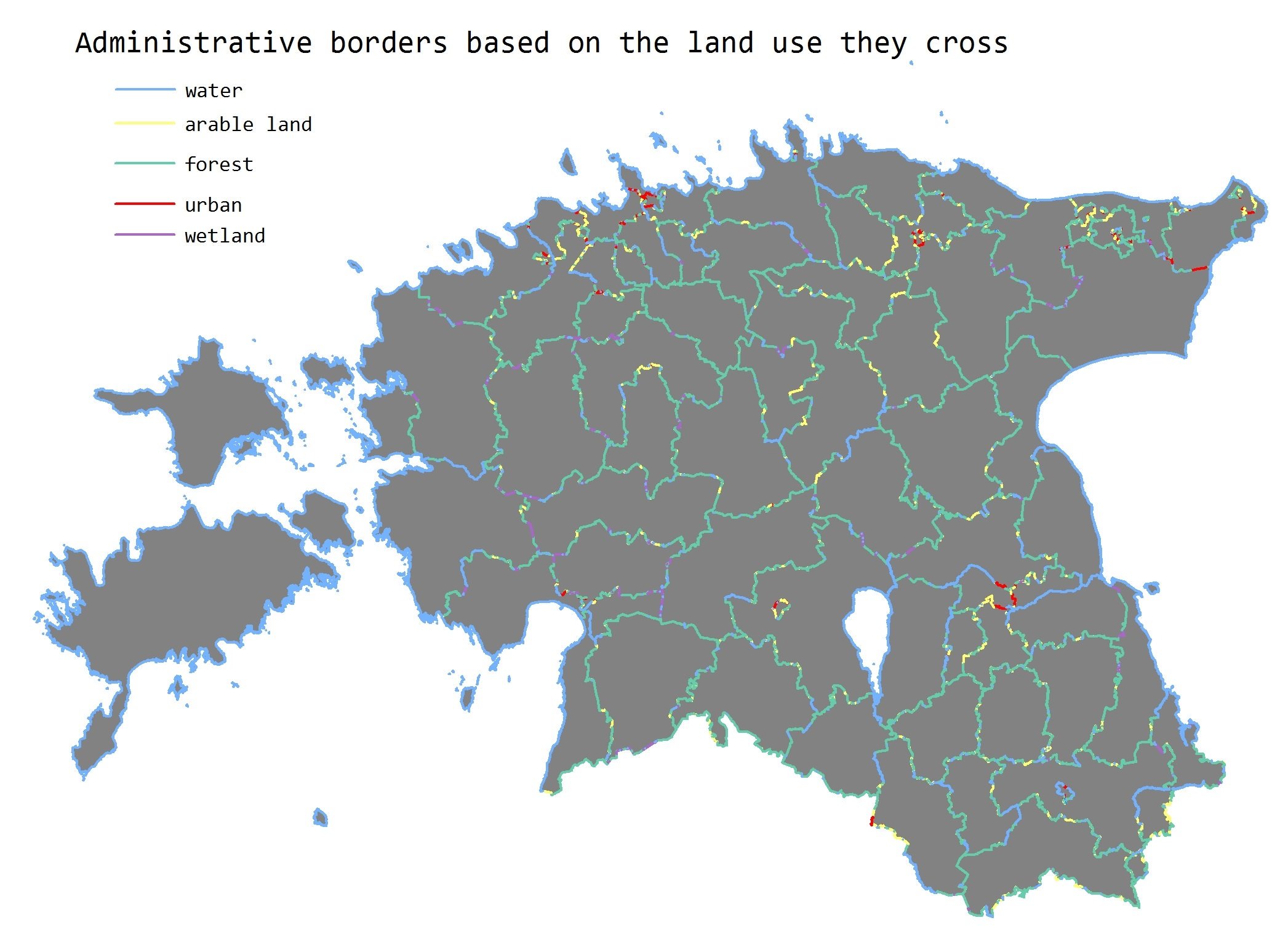
Day 14 - Borders - Administrative borders based on the land use they cross
The 14th day - BORDERS.
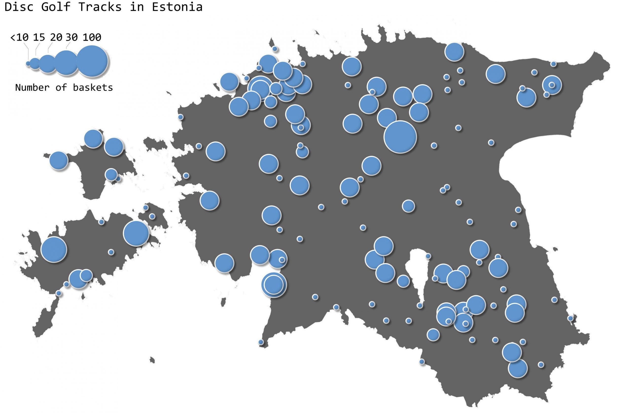
Day 13 - Tracks - Disc golf tracks in Estonia
THe 13th day - TRACKS. Again not easy to find open data about tracks. I stumbled over a page discgolfirajad.ee which has collected all the discgolf tracks in...
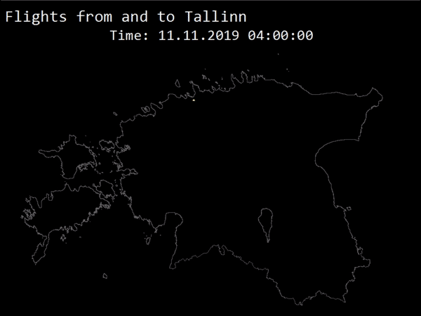
Day 12 - Monday morning flights to and from Tallinn airport
The 12th day - MOVEMENT. THere is not much open data about movement in Estonia. Therefore, I downloaded 1 day data from Flightradar but there is also a limit...
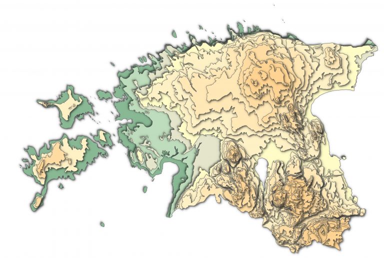
Day 11 - Elevation - Papercut elevation map of Estonia
The 11th day - ELEVATION. Paper cut map style - one of the styles I’ve wanted to try since I first saw it. I believe, the original style is actually from ESR...
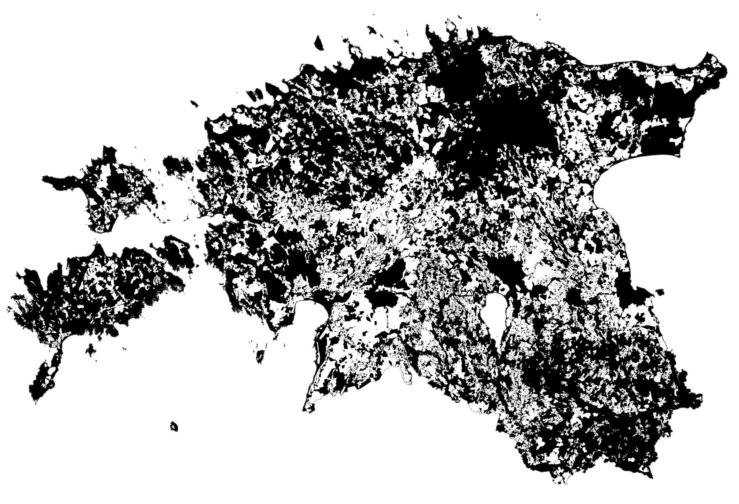
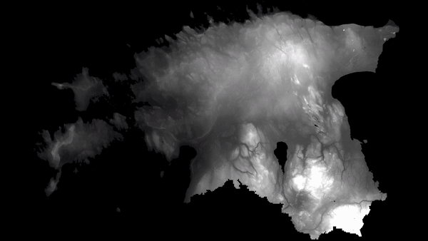
Day 10 - Black and white - Drainage (white) in Estonia
The tenth daya - BLACK AND WHITE. Some things are beautiful in their simplicity. The drainage is mapped as white on the map. Quite surprising, how “wet” Esto...
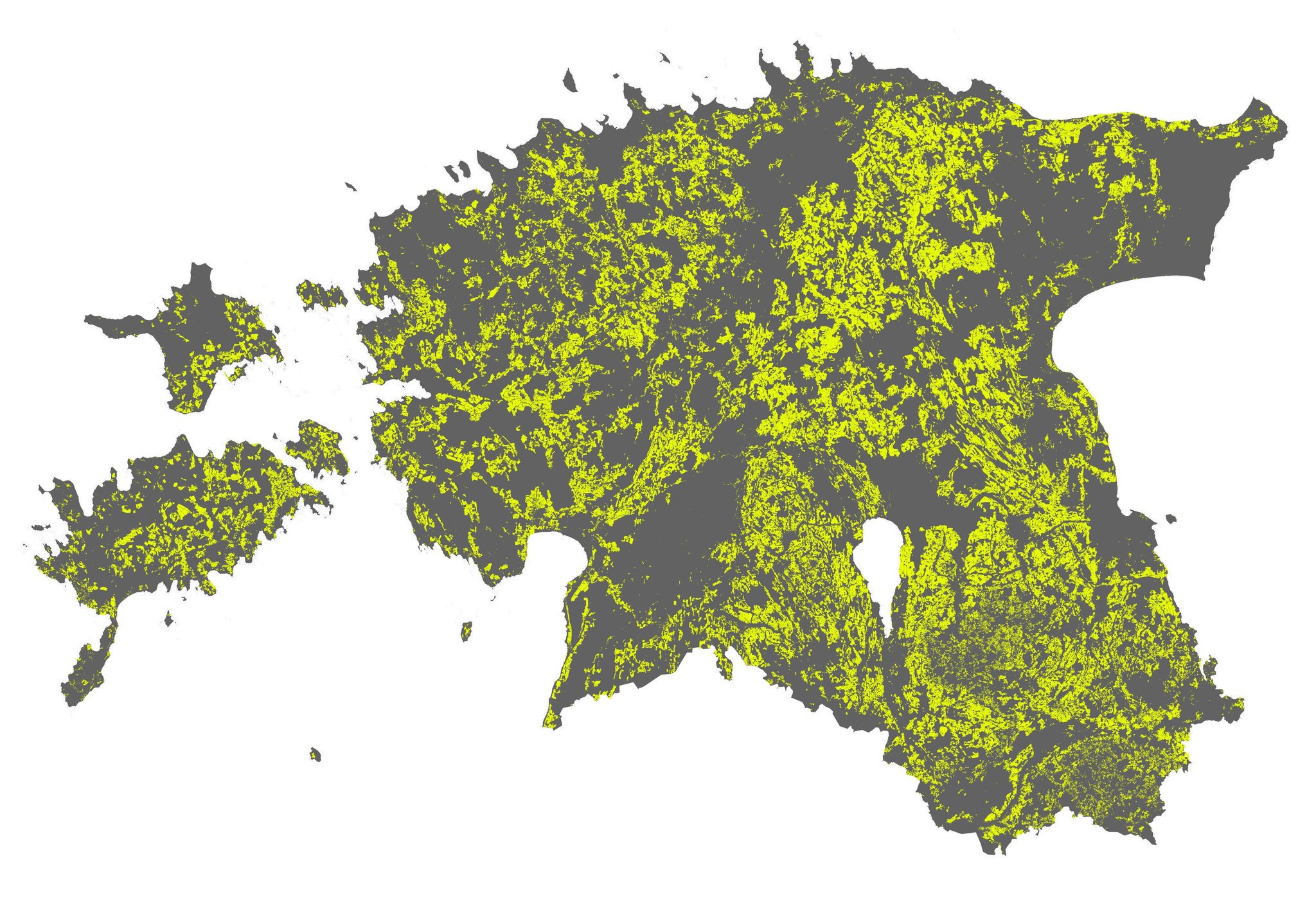
Day 9 - Yellow - Arable land in Estonia
The ninth day - YELLOW. For a geographer who reads maps all the time, yellow probably associates with arable land as it is often colored red in maps. Therefo...
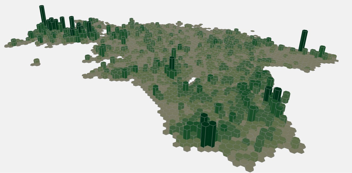
Day 8 - Green - Cultural heritage objects in Estonia
The eight day - GREEN. Time to try something new - 3D in QGIS. Not that green has any meaning fro cultural heritage objects but that was just another dataset...
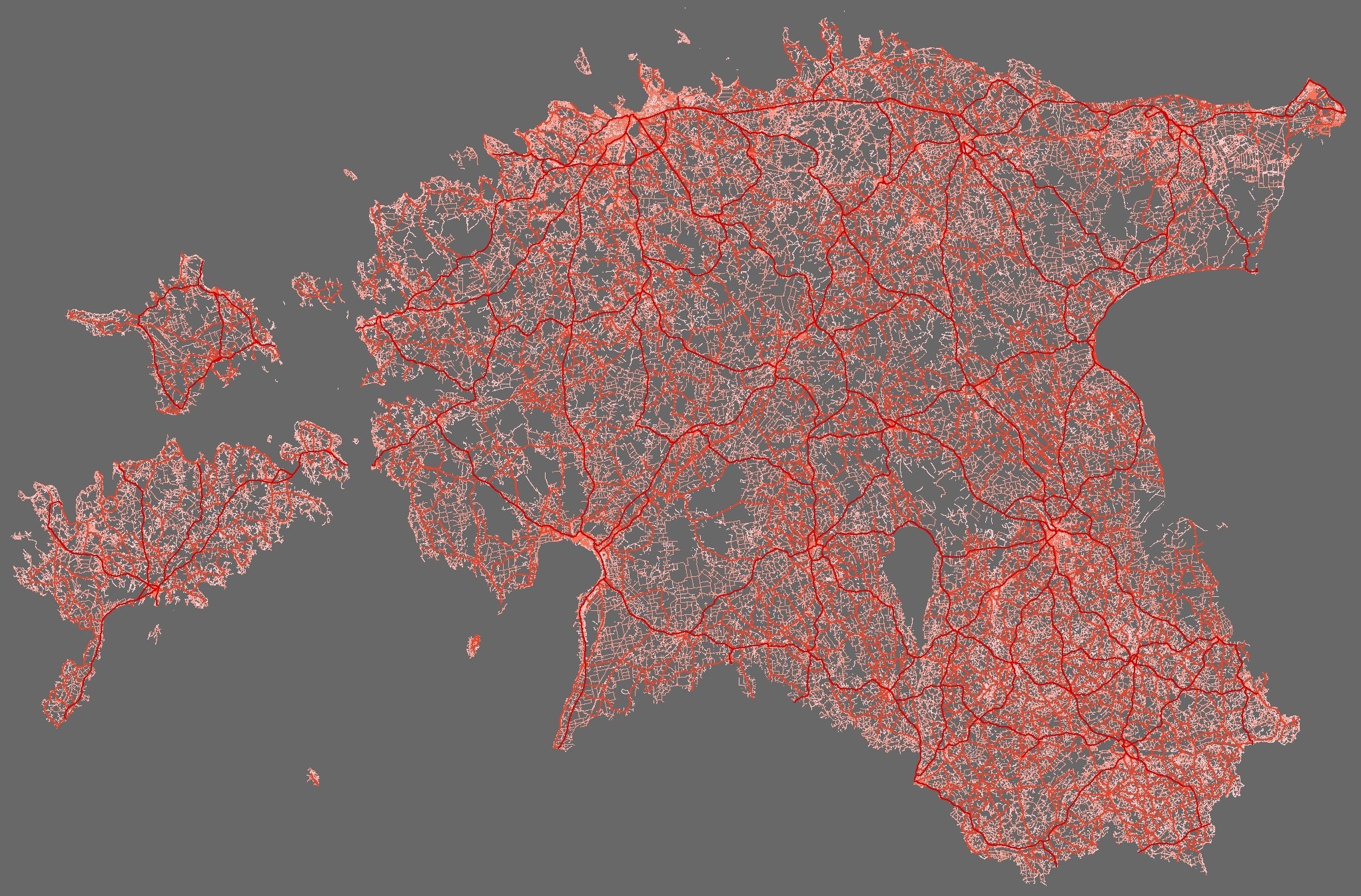
Day 7 - Red - All roads in Estonia
The seventh day - RED. Didn’t have much time nor great idea for red, so I just visualised all Estonian roads as red. Data from Estonian Topographic Database.
Day 6 - Blue - What if we flood Estonia up to 100m
The sixth day - BLUE. Water is blue, so a little experiment to flood Estonia.
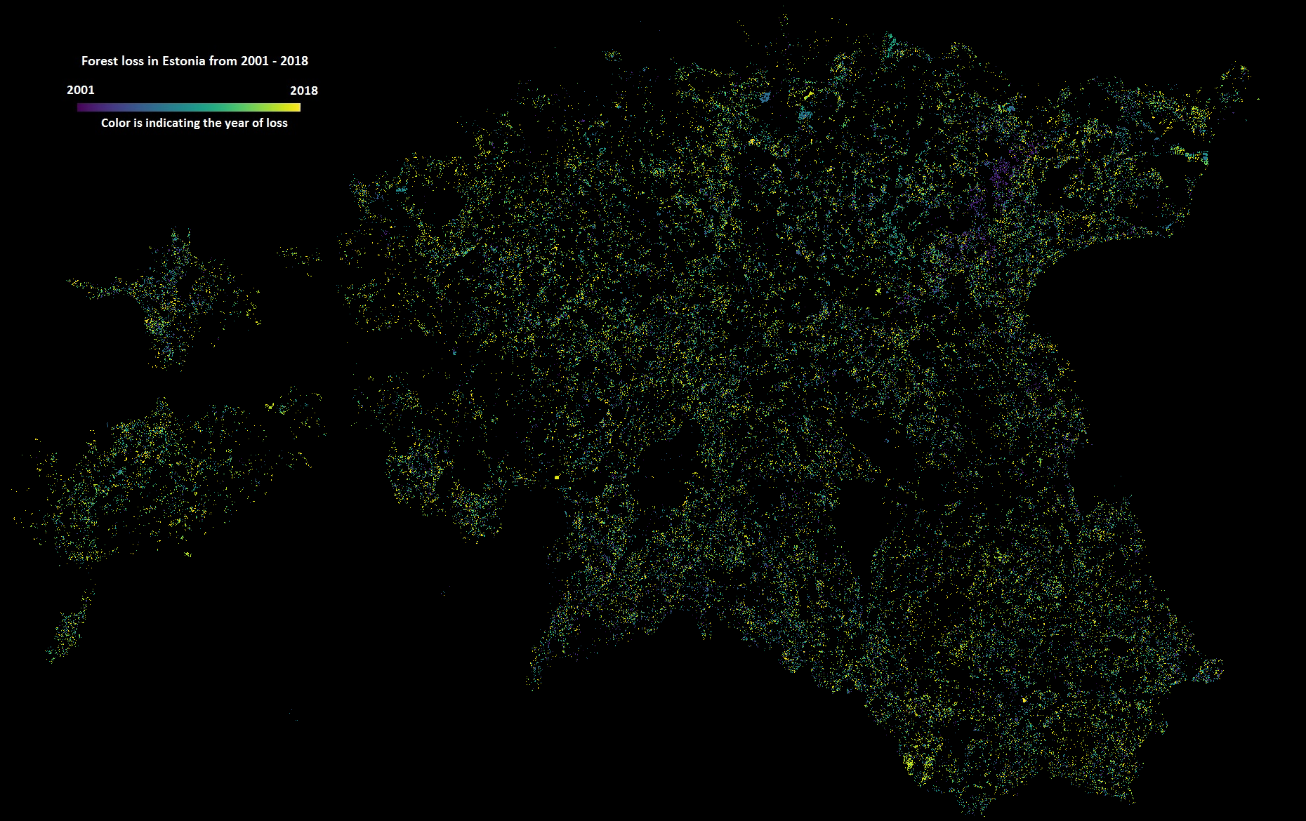
Day 5 - Raster - Forest loss in Estonia from 2001–2018
The fifth day challenge was RASTER. A lot debated forest management came to my mind when thinking of the suitable data to map. As I have been recently workin...
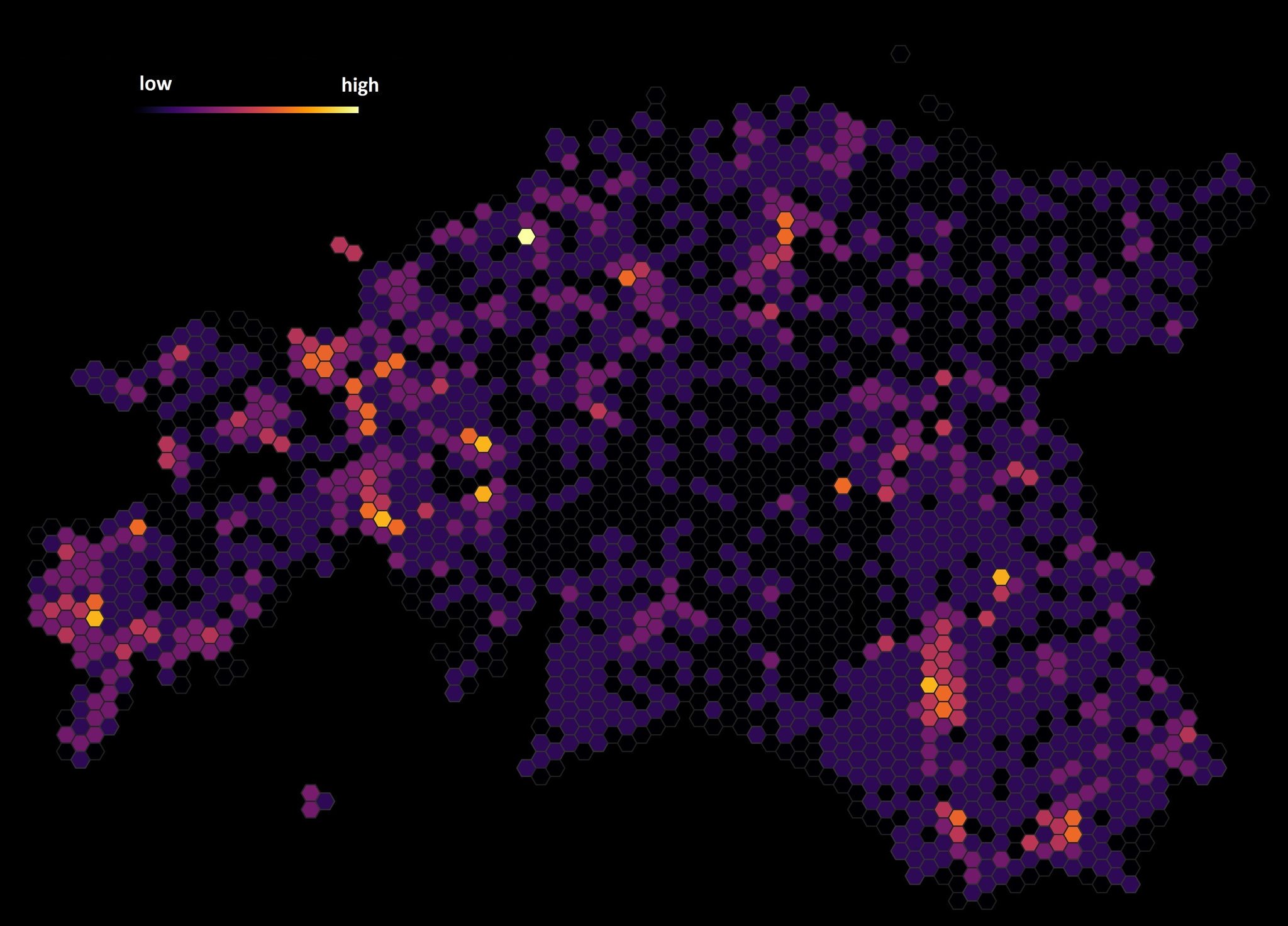
Day 4 - Hexagons - Endangered species (protection category III) in Estonia
The fourth day challenge was HEXAGONS. Hexagons are a bit trendy geospatial stuff now. However, in many ways they are quite practical for spatial analysis be...
Day 3 - Polygons - Distribution of bedrock outcrops in Estonia
The third day challenge was POLYGONS. The idea was inspired by one of the discussions with my colleague over geological maps and why one can never see the ge...
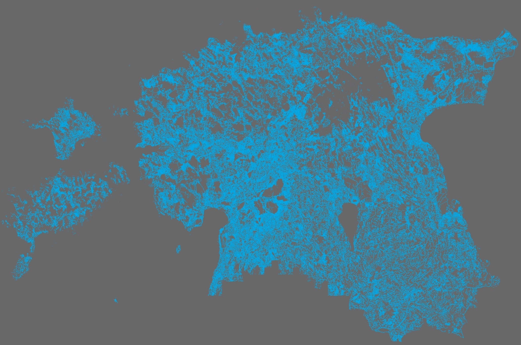
Day 2 - Lines - All streams in Estonia
The second day challenge was LINES. As my research is related to hydrology then the obvious choice was to visualise Estonian stream network. Data is obtained...
Day 1 - One year of traffic accidents (2016) in Estonia
The first day challenge was POINTS. I used Estonian Road Administration dataset (unfortunately not open data) for traffic accients from year 2016 and made a ...
Day 0 - MapChallenge Categories
In the end of October 2019 Topi Tjukanov announced the 30 Day Map Challenge in Twitter. So, anyone taking the challenge should make one map per day in whole ...